


By
Juan Jose Peñaranda Arregocés
The Board of Corpoguajira, approved the agreements through which two new protected areas are declared in the department. It is the Integrated Management Districts (DMI) Cuenca Baja del Río Ranchería y Delta del Río Ranchería.
Lower Rio Rancheria
The area has an extension 32.443 hectares, located between the municipalities of Riohacha, Manaure, Maicao y Albania.
Corpoguajira, in partnership with the Foundation Biota, retains Colombia, the Fund for Environmental Action and Children, The Nature Conservancy y Cerrejón; carried out the work of characterization and planning DMI, which they allowed to establish jointly with local actors, the viability of its declaration as a protected area.
Conservation objectives stand out among others: protect forest ecosystems dry and very dry tropical, existing in the Lower Rio Rancheria, to ensure the survival of species of flora and fauna present and the maintenance of essential environmental services to ensure human well-being of its people, especially those related to the water supply of the most important water body Peninsula.
The declaration also helps ensure the permanence of vertebrate species threatened with extinction, protect the habitats of migratory birds and boreal water supply for the development of environmentally sustainable productive activities.
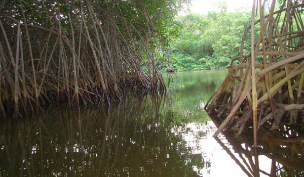
Rancheria River Delta
Abarca 3.601 hectares, distributed among the municipalities of Riohacha and Manaure.
Studies for declaratory, They were carried out hingedly connected Corpoguajira, Caribbean Environmental Heritage Foundation, the Fund for Environmental Action and Children (Preserves Colombia Program) and Cerrejon.
Among the conservation objectives of the DMI, They stand out: prioritize environmental recovery activities for sustainable use and enjoyment, since the delta is highly involved in its dynamics, due to factors such as urbanization, pollution and the high pressure of its main resources. Develop environmental education and ethno-ecotourism and restore and sustain the cultural and archaeological heritage.
The process involved in traditional authorities 24 Indigenous communities in the area.
A DMI is a geographical area, in which landscapes and ecosystems retain their composition and function, although its structure has been modified and whose natural and associated cultural values are placed within reach of the human population to be allocated to sustainable use, preservation, restoration, understanding and enjoyment.
Leave a reply
I am sorry, you should be connected to post a comment.