


The continental wetlands in the department of La Guajira present an environmental problem centered on the fact that they do not have delimitation in urban and rural areas caused by factors such as: lack of basic and technical information, poor technical and financial capacity, lack of knowledge of the regulatory standards for the protection of wetlands of territorial entities and the community, and as effects a decrease in the receiving capacity of the strategic ecosystem, deforestation in the water round, soil desertification due to conditioning for agricultural activities, increased risk of flooding, increased erosion, which together have an impact on the socio-economic development of the region and the quality of life of the population..
This problem is reflected in the wetlands of the municipalities of Riohacha, Dibulla, Maicao, Manaure and Urumita, affected by the illegal appropriation of their protection strips by individuals, causing not only the loss of environmental goods and services represented especially by fauna and fishing resources, but also generating a social problem between fishermen and land owners for the exploitation of natural resources..
Due to the above, the need arises from the Regional Autonomous Corporation of La Guajira to counteract this environmental problem., since there is no precise information on the protection strip in the wetland complexes, State entities have in some cases proceeded to title these areas, leaving the population exposed to suffering damages derived from floods that cyclically and due to climate change become more frequent.
Corpoguajira in its responsibility to preserve and conserve these aquifers and in accordance with the need raised and in response to the above., begins the execution of the project “STUDY FOR THE DELIMITATION OF CONTINENTAL WETLANDS IN THE DEPARTMENT OF LA GUAJIRA”, which was duly made viable and approved for execution.
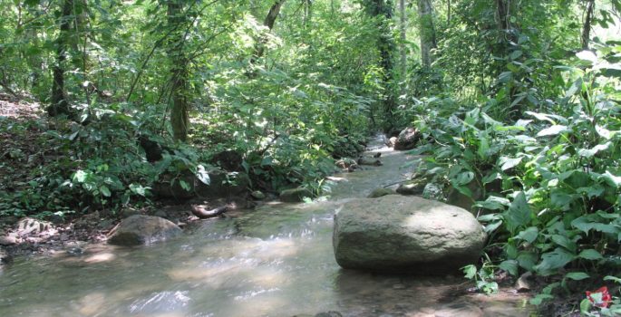
The following wetlands will be included within its execution: laguna Caricales (Riohacha); dutch beach, lagoon the tip, flower lagoon, the stony swamp and swamp (Dibulla); Eurare lagoon and Pitpir lagoon (Manaure); glory spring (Urumi) y laguna kurit (Maicao), where the delimitation will contribute to the conservation of water resources, fauna, flora and the inclusion of these strategic ecosystems in the territorial planning processes of each municipality involved.
In a period of 11 months the social characterization will be carried out, environmental and productive wetlands, GIS cartography and multi-temporal analysis will be developed, property evaluation and analysis will be carried out, Training workshops will be held on risk management and wetland protection standards and dissemination and dissemination of the information generated will be carried out., in order to determine in turn the uses that can occur around each wetland, since they are agricultural or livestock municipalities.
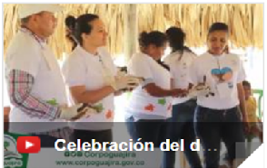
Last Friday, the Corporation carried out the socialization in the municipality of Urumita, informing the inhabitants of the area of how the execution will be carried out and taking careful note of each suggestion., ending the tour with a visit to the La Gloria wetland, being one of those covered by the delimitation project.
Leave a reply
I am sorry, you should be connected to post a comment.