


By: Luis Manuel Rodríguez Romero
Civil engineer
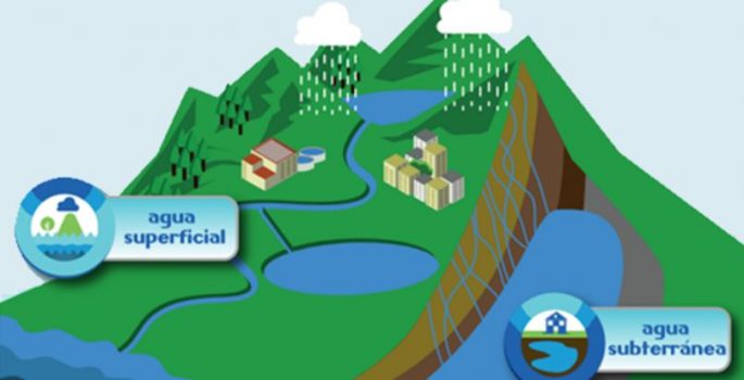
Information System of Water Resources – HRIS is an information tool that integrates data and manages knowledge related to the hydrological cycle to support decision-making about management, planning and water governance.
The HRIS includes five components and their effect have the offer, corresponding to behavioral data, water availability and interactions between surface and underground sources; la Demand water resource is associated with the identification of the amount of water per unit time being exploited by different resource users according to their activities; management of this information is done through the Resource User Registration Hídrico- Rurh.
Another component is Quality, know the property of water at a specific point of a water source identifying means available to be seized. The HRIS has a quality module that consolidates the results of measurements made in this regard monitoring points.
Within the HRIS they are offered tools to record provisions defined in the Plans of Water Resources, Porh and Management Plans and Watershed Management, POMCAS. On the other hand, analysis of human capabilities for management and research related to water is contemplated; counting on Risk, that for analysis data is available on the fragility of ecosystems, areas where there is high demand and generating exhaustion, events that decrease the surface flow or affect recharge, and events enlarged or reduced dynamics of surface water.
Among the advances in reporting information is managed in the HRIS, They have registered 202 water sources associated with 1.040 Users they have the technical information of deposits and characterization of water use, and they have water concessions and permits vertimientos, with 276 georeferenced sections and characterized defined in Porh with quality objectives established in 1.182 properties associated with water uptakes and duly authenticated vertimientos with 1.034 concessions water whose technical information has completeness and standards established in the HRIS; 3.282 Water uptakes legalized between aljibes, wells, springs, bocatomas and other derivations, as well as 216 points belonging to the network of monitoring water quality, to determine the quality of the supply sources of the aqueducts, compliance with the quality objectives of water bodies, reducing the pollution load current discharges and pesticide contamination levels, pesticides and hydrocarbons, counting on 4.194 measurement data corresponding to the physicochemical characterization of water.
Have also been 4 Porh formulated and approved as a tool to intervene systematically water bodies, for proper management and utilization of water resources; 21 efficiency programs and water saving (PUEAA), submitted by users and approved by the Corporation; and 48 Projects established in PUEAA, whose purpose is the conservation and supply basins aquifer recharge areas, optimization of aqueducts, reducing consumption, water reuse, inter alia.
Leave a reply
I am sorry, you should be connected to post a comment.